The best hikes on the Sunshine Coast range from short family strolls to multi-day rainforest expeditions. Top picks include Mount Ngungun (2.8 km, grade four) for 360-degree Glass House Mountains views, Kondalilla Falls (4.8 km, grade three) for a 90-metre waterfall, and Mount Coolum (grade four) for coastal panoramas. Difficulty ranges from gentle grade-one family walks to demanding grade-four full-day and multi-day treks.
The best trails are often just a short drive away. Whether you’re conquering a 25-million-year-old volcanic dome, chasing a waterfall, or settling in for a four-day rainforest expedition, the region delivers everything from sandy beach strolls to rocky alpine scrambles. Many of these walks reward effort with something genuinely special. A 360-degree view that makes your legs forget they hurt, a waterfall pool suitable for a swim, or the kind of silence that only rainforest produces await.
Quick Comparison: Sunshine Coast Day Hikes and Great Walks
| Hike | Distance | Grade | Time |
|---|---|---|---|
| Mount Ngungun Summit Walk | 2.8 km return | Grade 4 | Allow 2 hours |
| Kondalilla Falls Circuit | 4.7 km | Grade 3 | Allow 2–3 hours |
| Linda Garrett Circuit | 700 m return | Grade 2 | Allow 20 minutes |
| Mount Coolum Summit Walk | 1.6 km return | Grade 4 | Allow your own pace |
| Ben Bennett Bushland Park | 1.5 km circuit | Not officially graded | Allow your own pace |
| Conondale Range Great Walk | 56 km circuit | Grade 4 | 4 days |
| Sunshine Coast Hinterland Great Walk | 58.8 km | Grade 4 overall | Multi-day |
Mount Ngungun: 360-Degree Views from the Glass House Mountains
The Glass House Mountains are the Sunshine Coast’s most distinctive landmark, and Mount Ngungun is your ticket to seeing why. The walk is steep enough to make you feel like you’ve earned it, but not so brutal that you’ll regret the decision by the time you’re halfway up.
The Mount Ngungun summit walk is a 2.8 km return, Grade 4 track that climbs through open forest and fern understorey to the 253 m summit. Along the way, the track passes a small rock overhang and offers views towards Mount Tibrogargan. From the summit, you’ll be rewarded with spectacular 360-degree views across the surrounding landscape, including the distinctive peaks of Mount Tibrogargan, Mount Coonowrin and Mount Beerwah. Allow around two hours for the return walk, stay well clear of cliff edges and plan to complete your hike during daylight hours.
What to expect: Around 45 minutes to the summit, steep rocky sections (take care if it’s wet), and a brief descent on the return. Bring water; there’s no shade at the top, and the exposed rock catches the heat.
Best time to visit: Early morning to avoid crowds and heat. Sunset hikes are popular, but the descent in fading light requires a torch and care on the rocky sections.
Kondalilla Falls: A 90-Metre Waterfall and Rainforest Immersion
Kondalilla Falls is one of the Blackall Range’s standout natural attractions, where Skene Creek drops 90 metres into the lush rainforest valley below. The walk takes you past rock pools and waterfall views before descending through subtropical rainforest to the base of the falls.
The Kondalilla Falls circuit is a 4.7 km, Grade 3 walk that takes around 2–3 hours to complete. Be prepared for a workout: the circuit includes more than 300 stairs, and you’ll need to climb them again on the return journey. Along the way, look out for towering bunya pines, piccabeen palms and native birdlife as the track moves through the rainforest. If you’re tempted to cool off in the rock pools, take extra care around the water because depths can be unpredictable, rocks may be slippery and diving is unsafe.
The catch: The walk is downhill on the way in, which means uphill on the way out. The 300 stairs can be muddy in wet weather, and the final section back to the car park is the toughest part of the day.
Longer option: The Baroon Pocket track also leads to Kondalilla Falls but stretches 20 km and takes five hours. Reserve it for a day when you’ve got time and legs.
Seasonal note: Waterfall flow is highest in winter (June to August) after rainfall.

Gheerulla Falls: A Lesser-Known Waterfall Without the Crowds
Gheerulla Falls is tucked within Mapleton National Park along the Sunshine Coast Hinterland Great Walk, making it better suited to experienced walkers looking for a longer hinterland adventure than a quick waterfall stop. The surrounding route passes through dry woodland, wetter forest and the Gheerulla Creek landscape, with expansive views across the Gheerulla Valley along the way.
On the official Great Walk route, the section from Thilba Thalba walkers’ camp to Gheerulla Falls is 8.8 km one way, Grade 4, and takes around four hours. A short 100 m spur track leads from the main trail to the falls. From Gheerulla Falls, the Great Walk continues for another 7.3 km to the Delicia Road entrance, so plan your route, transport and turnaround point carefully before setting out.
Best season: Winter (June to August), when rainfall keeps the falls gushing. Post-downpour mud can be slippery, so watch your footing on the way back up.
When to skip it: After heavy rain, the track can be treacherous. Check with Mapleton National Park about access before you go.
Conondale Range Great Walk: Four Days in Rainforest and Open Sky
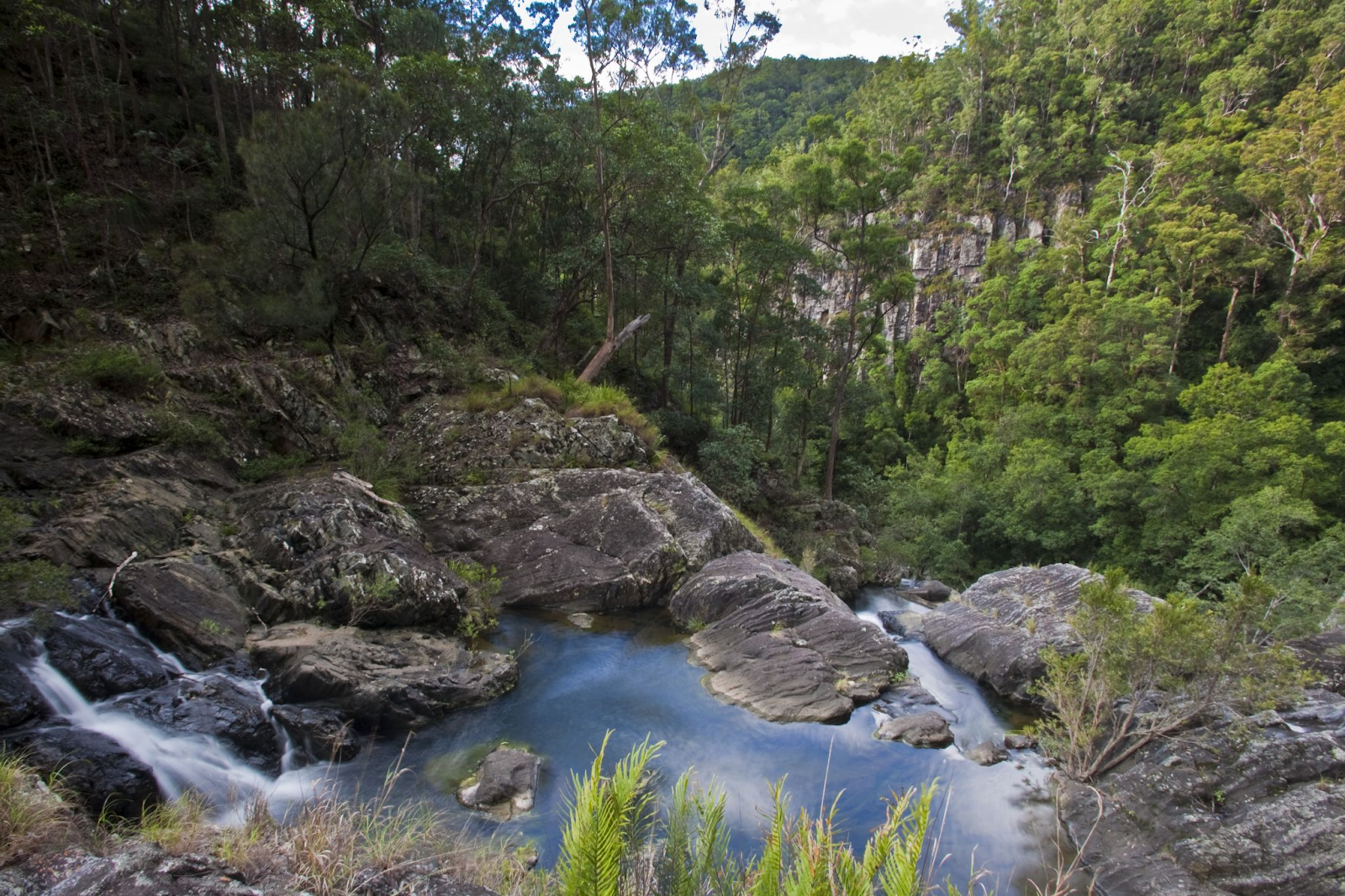
The Conondale Range Great Walk is the multi-day option for experienced hikers ready to carry their gear and spend several days exploring the rugged landscapes of Conondale National Park. The 56 km, Grade 4 circuit is designed as a challenging four-day walk, taking you through ancient rainforest, tall open forest, deep gorges, cascading creeks and waterfalls, with expansive views from higher sections of the range.
The track starts and finishes at Booloumba Creek day-use area and includes some very steep sections and creek crossings. Three remote walkers’ camps—Wongai, Tallowwood and Summer Falls—provide designated overnight stops along the route. Each has campsites, a toilet and untreated water, but walkers need to carry their rubbish out and treat all water before drinking. Camping permits must also be booked in advance.
The four official sections are:
Day 1 – Booloumba Creek day-use area to Wongai walkers’ camp: 11 km one way | Allow 6 hours
Day 2 – Wongai walkers’ camp to Tallowwood walkers’ camp: 17 km one way | Allow 8 hours
Day 3 – Tallowwood walkers’ camp to Summer Falls walkers’ camp: 15.2 km one way | Allow 7 hours
Day 4 – Summer Falls walkers’ camp to Booloumba Creek day-use area: 12.8 km one way | Allow 6 hours
The full circuit is remote and rugged, so it is best suited to physically fit and experienced bushwalkers who are properly prepared for changing conditions. Check current Queensland Parks alerts before setting out, particularly for track works, fallen trees, fire conditions and weather-related closures.
Booking essential: You must book campsites in advance through the Queensland Parks and Wildlife Service.
Experience: Crystal-clear creeks, waterfalls, expansive ridge views, and the kind of solitude you won’t find on day hikes. The walking is shared with mountain bikers, so you’ll see bikes on the track but rarely congestion.

Mount Coolum: A 25-Million-Year-Old Dome with Coastal Views
Mount Coolum rises 208 metres above sea level and was formed around 26 million years ago, when molten magma pushed into the surrounding sandstone and cooled beneath the Earth’s surface. Today, the distinctive volcanic dome offers one of the Sunshine Coast’s most rewarding short summit walks.
The Mount Coolum summit walk is a 1.6 km return, Grade 4 track, with around two hours recommended for the return journey. Although relatively short, it’s suitable for fit walkers only, with steep, rocky sections, loose gravel and natural rock steps along the way. From the summit, you’ll be rewarded with sweeping views towards Noosa Heads to the north, the Blackall Range to the west, and Point Cartwright and the Glass House Mountains to the south.
The first section winds through native bushland: pleasant, relatively easy. Then it ramps up. The rocky section toward the summit demands care, especially if it’s wet. Allow 45 minutes to ascend and about 30 minutes to descend; it’s graded four, though it’s one of the Sunshine
Coast’s simpler grade-four walks.
Why it’s popular: Families tackle it, visitors come to see the view, and the car park is large enough that you won’t arrive to a full lot (though it does fill on weekends). The reward, a 360-degree panorama and a place to sit and eat lunch, justifies the effort.
Timing: Early morning or late afternoon to avoid the midday heat on exposed rock.

Ben Bennett Bushland Park: Three Trails in a Lesser-Known Sanctuary
Ben Bennett Bushland Park protects 21 hectares of native bushland in central Caloundra, offering an easy way to experience several different vegetation communities without venturing far from town. Around a dozen trails weave through the reserve, ranging from approximately 800 m to 1,100 m return, while a 1.5 km circuit provides a longer option. Along the way, you’ll pass through Melaleuca and eucalypt forests, coastal heath and one of the area’s remaining pockets of coastal lowland vine forest.
Access is from Queen Street, where you’ll find bitumen parking and an information board. The reserve also has toilets, electric barbecues, picnic tables and shelters, making it suitable for combining a short bushwalk with a picnic. More than 150 plant species have been identified within the reserve, and birdwatchers can keep an eye out for native species including the glossy black-cockatoo. Three short trails (all 1–2 km return) let
you choose your ecosystem:
Rainforest Trail: Subtropical rainforest canopy and creek crossings.
Heath Trail: Open bushland with wildflowers and birdlife.
Eucalypt Trail: Drier woodland, typically the warmest of the three.
Best for: A 30-minute to one-hour outing. Birdwatchers love the variety. Families appreciate the facilities and the fact that if someone gets tired, you’re never far from the car.
Sunshine Coast Hinterland Great Walk: 58.8 km Through Four National Parks
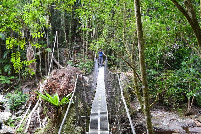
The Sunshine Coast Hinterland Great Walk is one of the region’s major multi-day hiking experiences, covering 58.8 km through the scenic Blackall Range. Allow at least four days to complete the entire route, which passes through three national parks: Kondalilla, Mapleton Falls and Mapleton.
The Grade 4 Great Walk takes you through changing landscapes, from subtropical rainforest and tall open eucalypt forest to creeks, waterfalls, ridges and lookouts with sweeping hinterland views. Some sections are steep and rugged, and the track can become muddy and slippery after rain, making good preparation and suitable hiking footwear essential.
Three remote walkers’ camps namely Flaxton, Ubajee, and Thilba Thalba provide overnight stops along the route. Camping permits are required and campsite numbers are limited, so QPWS recommends booking well ahead. Each walkers’ camp provides platform seating, untreated water and a toilet, but you’ll need to carry out all rubbish and treat water before drinking.
Alternatively, you can stay in nearby accommodation and walk selected sections or complete shorter day hikes that access different parts of the route.
Highlights: Immersion in rainforest without the intensity of remote wilderness. You’ll pass multiple waterfalls, meet other walkers, and have access to water and shelter each night. The variety, rainforest, ridge lines, creek crossings, open views, means no two days feel the same.
Planning note: Book walkers’ camps well in advance (they fill quickly during school holidays). If you prefer not to camp, Sunshine Coast Getaways offers self-contained apartments in Mooloolaba, Alexandra Headland and Maroochydore offering the best of both worlds. Consider a beach holiday with a day hike to enjoy our beautiful Sunshine Coast hinterland.
Safety Tips for Sunshine Coast Hiking
Before you head out, consider these practical precautions. The Sunshine Coast’s weather changes quickly, so check the forecast and trail conditions before you leave. Let someone know your itinerary and expected return time; if you don’t show up, they’ll raise the alarm.
Essential gear: Sturdy, broken-in hiking boots (blisters ruin days); a map and compass or GPS device and the knowledge to use them; plenty of water (at least 2 litres for a half-day hike); sun protection including hat and sunscreen; and a basic first-aid kit. Phone reception is patchy in national parks, so don’t assume you can call for help.
On the trail: Stay on marked tracks. Bushwhacking damages vegetation and you can get lost quickly. Be aware of weather changes; afternoon thunderstorms are common in summer. If the sky darkens, descend open ridges quickly; lightning is a real risk on high exposed ground.
Snakes and other wildlife may be encountered on Sunshine Coast hiking trails. Snakes generally retreat when encountered, but they can become defensive if they feel threatened. Stay on formed tracks where possible, wear enclosed footwear and protective clothing, and never approach, handle or provoke a snake. If you encounter one, back away to a safe distance and allow it to move away. Carry a first-aid kit with pressure bandages and know the correct first-aid procedure for snakebite. Treat any snake sighting as a reason to move away calmly and give it space.
[SOURCE: Surf Life Saving Queensland and Queensland Parks and Wildlife Service recommend these precautions as standard for outdoor activity in subtropical and tropical Queensland]
Respect the environment: Stick to designated trails. Don’t feed wildlife. Take all rubbish with you; “leave only footprints, take only memories” applies here.
Wildlife and Scenic Views on Sunshine Coast Hikes
Sunshine Coast hiking trails pass through a remarkable variety of habitats, from warm subtropical rainforest and tall open eucalypt forest to creeks, waterfalls and rocky gorges. The Blackall Range parks alone support more than 100 bird species, while the wider hinterland is also home to dozens of reptile and frog species.
Keep an eye and ear out for native birds as you walk. Wompoo fruit-doves can be heard in the rainforest, Australian peregrine falcons occur around Mapleton Falls, and Australian brush-turkeys are frequently seen at Kondalilla National Park. Kookaburras, currawongs and other native birds may also be encountered along the Sunshine Coast Hinterland Great Walk.
Creeks and wetter forest habitats are particularly important for native frogs. Species recorded across the Blackall and nearby Conondale ranges include the endangered giant barred frog and vulnerable cascade treefrog and tusked frog. Wildlife sightings are never guaranteed, so walk quietly, stay on designated tracks and observe animals without feeding, handling or disturbing them.
The volcanic peaks of the Glass House Mountains (Coonowrin, Beerwah, Tibrogargan) dominate northward views.
Southward, on clear days, you see the hinterland’s layered ridges rolling toward the coast. Ridge-line sections offer panoramic views; rainforest sections provide canopy immersion and the sound of creeks. The contrast between these experiences is part of what makes Sunshine Coast hiking rewarding.
Best scenic viewing times: Early morning (crisp air, better visibility, often clearer views). Late afternoon (softer light, fewer hikers). Avoid midday heat on exposed walks; you’ll be miserable and the views will be hazy.
Hiking the Sunshine Coast Responsibly
Hike responsibly by staying on marked tracks, taking all rubbish with you, never feeding wildlife, and respecting any trail closures you encounter. National parks here are managed to balance access with conservation, and trails are designed and maintained to minimise erosion and environmental impact.
When you hike, you’re part of that system. Don’t harvest plants, lichens, or fungi, no matter how pretty. Respect closures; trails are sometimes closed for ecological recovery, track maintenance, or wildlife breeding seasons. If a trail is closed, don’t use it.
Local conservation organisations work continuously to protect the region’s biodiversity. By following guidelines (staying on track, taking rubbish, respecting wildlife), you’re actively supporting that work.